Automated 3D Landscape Modeling System
I. Problems Addressed and Product Positioning
In landscape design, many practitioners are hindered by the modeling process: after drawing 2D plans, they need to manually build 3D models, which takes 2-3 days just to adjust terrain and vegetation details for a single site; using parametric tools may restrict creativity with rigid rules, while deep learning-based scheme generation makes it difficult to control details (e.g., non-compliant road widths); after completing the model, evaluating the thermal comfort of pavement areas in summer requires switching to other tools for recalculation, which is time-consuming and labor-intensive.
To tackle these practical issues, a prototype of this system was developed based on the research outcomes of “Automatic 3D Landscape Modeling via the Integration of Parametric Design and Deep Learning”. Instead of making decisions for designers, this prototype aims to streamline and expedit the workflow of “drawing 2D plans—building 3D models—evaluating environmental performance,” essentially functioning as a “design auxiliary tool”. This prototype can help designers who need to cut down on time spent on repetitive modeling tasks, assist design institutions in rapidly generating multiple design schemes for clients to select from, and support research and teaching contexts in intuitively demonstrating the causal logic between design interventions and environmental impacts.
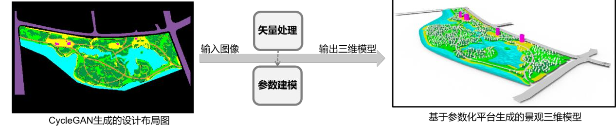 Figure 1 3D model generation process
II. Practical Value and Results
Testing indicates that it solves several core problems:
For small and medium-scale planning and design projects such as community parks and campus green spaces, previously it would take two or three days of modeling work. Now, by marking the existing green areas and water bodies on the site, a three-dimensional model can be produced in just half a day.
It is capable of generating 3 to 5 design schemes with diversified layouts, while ensuring that details such as road widths adhere to relevant technical specifications and avoiding homogenization in design outcomes.
No tool switching is needed after modeling. For environmental indicators such as pavement thermal comfort can be directly checked, eliminating the hassle of repeated data export and import.
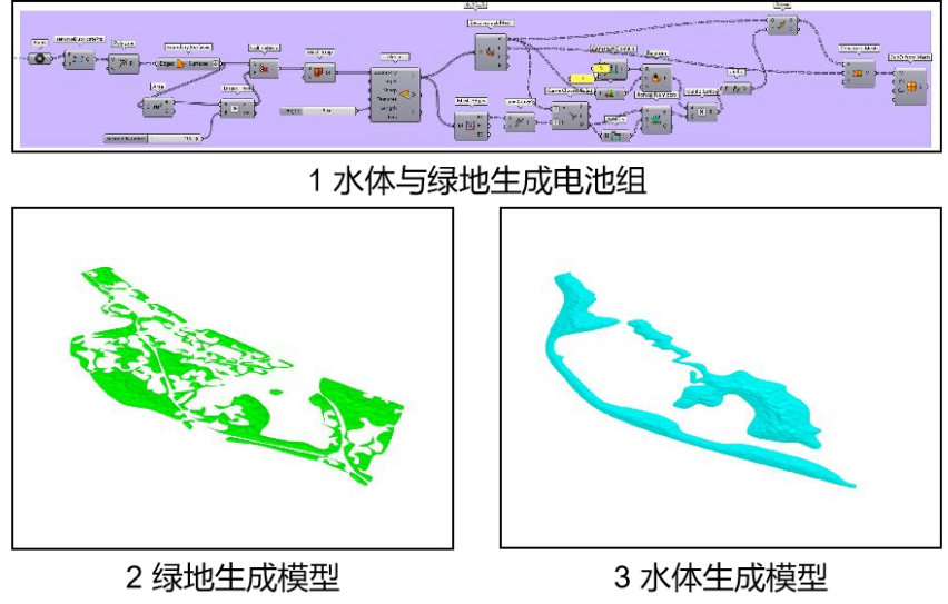 Figure 2 Water and green space generation and battery pack generation
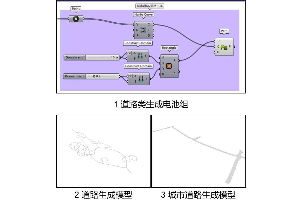 Figure 3 Road generation and road generation battery pack
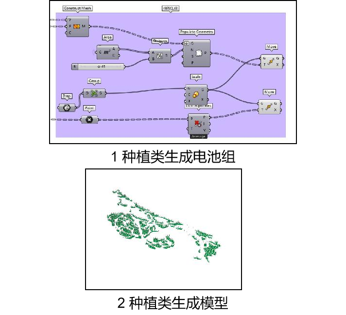 Figure 4 Planting generation and planting generation battery pack
Currently, this prototype can meet the demands of small and medium-scale sites, yet it still has room for optimization in terms of large-scale site modeling efficiency and interface simplification. If you are a landscape design enterprise aiming to enhance modeling efficiency, or a design software team seeking to integrate intelligent modeling functionalities, please feel free to contact us. We can provide comprehensive technical details to jointly refine system functions and promote practical implementation of this technology, and ultimately enable this prototype to truly serve industry applications while facilitating the further transformation of the research team’s academic achievements.