AIGC-Powered Auxiliary Tool for Landscape Architecture Image Generation and Evaluation
I. Problems Addressed and Product Positioning
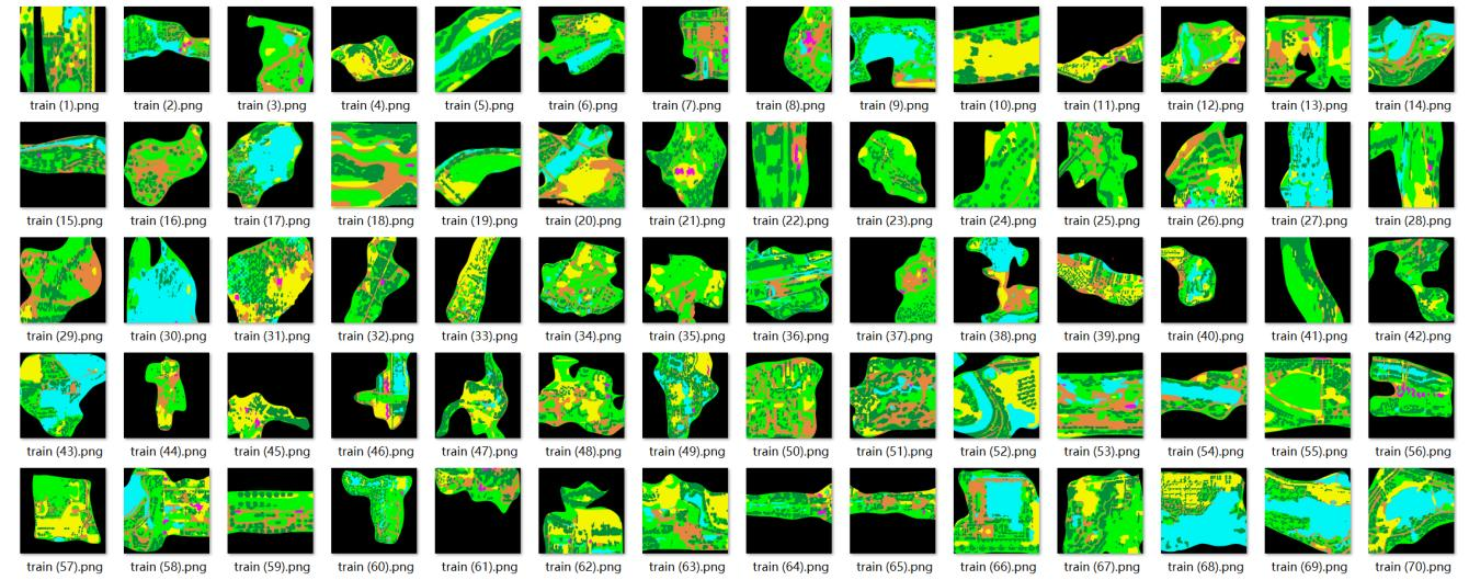 Figure 1 Partial Machine Tracing Dataset
When landscape architects generate landscape architecture images using AIGC, they often encounter three key challenges: 1) Unstable generation quality—either the representation of landscape elements (e.g., water bodies, vegetation) is unprofessional, or the style deviates from drawing specifications; 2) Lack of unified evaluation criteria for assessing generated images, leading to high error rates when relying solely on subjective perceptions; 3) Most AIGC tools feature complex operations that require learning parameter tuning, posing significant barriers to entry for non-technical landscape architects.
To address these pain points, we developed a prototype of an auxiliary tool for landscape architecture image generation and evaluation based on AIGC technology (e.g., integrating algorithms such as Stable Diffusion and GANs). Instead of replacing landscape architects' creativity, it is positioned as a "lightweight professional auxiliary tool"—capable of helping landscape architects quickly generate landscape site plans ( layout renderings of community parks and pocket parks) and automatically evaluating performance from two dimensions: quality (clarity, element accuracy) and efficiency (generation time). It meets the needs of design firms and landscape management departments for rapid drawing production and scheme comparison, enabling landscape architects to operate it without specialized technical knowledge.
II. Practical Value and Effectiveness
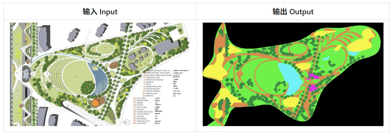 Figure 2 Landscape Architecture Plan Tracing Machine" Function Example
From testing, the tool addresses core needs:
Enhanced generation efficiency: Manually creating a set of landscape plans typically takes 2-3 hours. Now, by inputting basic layouts and style requirements, plans can be generated within 30 minutes, with support for batch generation of 3-5 schemes in different styles.
Guaranteed quality: It automatically verifies whether the generated plans comply with landscape mapping standards (e.g., clarity of boundaries between vegetation and roads), avoiding professional deviations such as "water bodies rendered as gray blocks" and reducing misjudgments by 40% compared to pure manual inspection.
Low operational threshold: No coding skills are required. Users can generate expected plans by selecting styles (e.g., fresh and minimalist, photorealistic) and inputting key requirements (e.g., "incorporate waterfront landscapes") via a simple interface.
Currently, the tool can stably generate small and medium-scale landscape plan drawings, supporting three mainstream styles, with an assessment system covering basic needs. However, there is room for optimization in customized styles (such as regional characteristic landscapes), interfacing with design software (such as CAD), and generating 3D renderings.
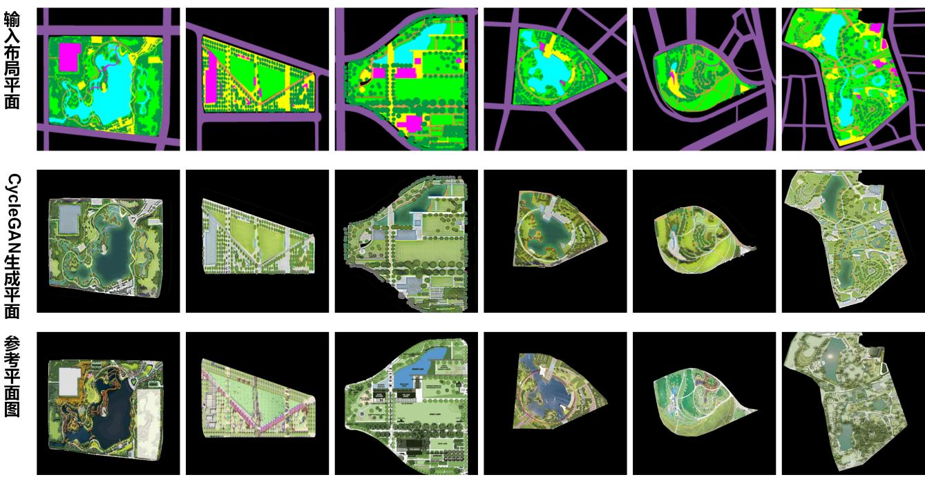 Figure 3 Optimization Algorithm Partial Generation Results
If you are a landscape design firm aiming to improve the efficiency of scheme drawing output, or a landscape software team looking to add AIGC-based image generation and evaluation functions to your products, we welcome you to contact us. We can provide customized adjustments to tools, such as developing exclusive style models and adapting to existing workflows, to jointly make technology more aligned with the actual needs of the industry and help promote the intelligent efficiency improvement of landscape design.