Ecosystem Service Assessment and Prediction Tool
I. Problems Addressed and Product Positioning
In ecological management of arid river basins, practitioners often face three major challenges: First, it is difficult to quantify the impact of land use changes (e.g., cropland expansion, urbanization) on core ecosystem services such as carbon storage, soil conservation, and water yield. Second, traditional assessments can only review historical changes and cannot predict ecological trends under different future development scenarios, leading to a lack of forward-looking data support for decision-making. Third, scattered data and complex analysis make it difficult to quickly identify key areas for ecological protection.
To address these challenges, based on the FLUS-InVEST coupled model, we have developed a prototype of the Ecosystem Services Assessment and Prediction Tool for arid river basins. Instead of replacing professional decisions, it is positioned as an “ecological planning auxiliary tool”—integrating multi-source data such as land use, climate, and terrain to quantify three core ecosystem services (carbon storage, soil conservation, water yield) and support trend prediction under four future development scenarios (baseline, low-impact, high-impact, sustainable). It adapts to three scenarios: government ecological management departments (river basin governance), environmental protection enterprises (ecological restoration projects), and planning and design teams (arid area project planning), providing data support for ecological decision-making.
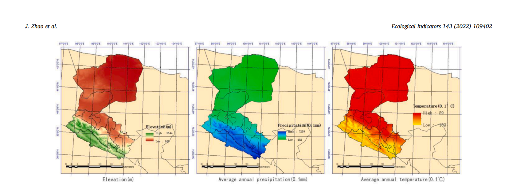 Figure 1 Details of the Heihe River Basin (HRB) Study Area (Digital Elevation Model, Mean Annual Precipitation)
II. Practical Value and Effectiveness
Actual measurement and prediction in the Heihe River Basin show that the tool has addressed core needs:
Quantification of historical changes: Clearly presenting the dynamics of ecosystem services from 1995 to 2020 (water yield slightly decreased by 0.03%, soil conservation decreased by 2.6%, and carbon storage first decreased then increased) without the need for manual integration of multi-source data.
Future trend prediction: Outputting changes under four scenarios from 2030 to 2050, such as the smallest decline in ecosystem services under the sustainable development scenario, providing clear references for decision-making.
Identification of key areas: Through spatial visualization, it clarifies key carbon storage areas in the Qilian Mountains and critical soil conservation areas in the middle and lower reaches, helping users quickly lock in priorities for ecological protection and restoration and reduce blind planning.
Currently, the tool is adapted to arid river basins, and the accuracy of core evaluation indicators meets the basic application needs of the industry.
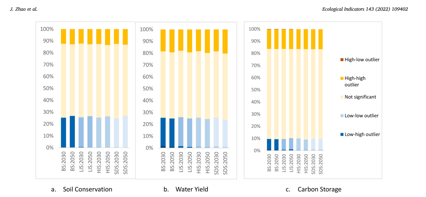 Figure 2 Area Statistics of Local Spatial Autocorrelation Analysis of Ecosystem Services in HRB (2030 and 2050 Scenarios)
The tool has completed case verification in the Heihe River Basin and still has room for optimization in multi-basin adaptation (e.g., other arid/semi-arid basins), more refined scenario settings (e.g., special ecological restoration scenarios), and connection to digital ecological management platforms. If you are a government ecological management department in need of data support for river basin governance, an environmental protection enterprise requiring an evaluation tool for ecological restoration projects, or a planning institution needing ecological prediction functions for arid area projects, please contact us. We can customize assessment modules for specific river basins, optimize scenario prediction parameters, or provide interfaces to adapt to existing management systems, making the technology more in line with the actual needs of ecological protection and planning and promoting the transformation of academic achievements into industry practices.